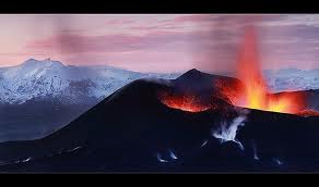
Iceland Volcanoes
Iceland sits astride the middle of the Mid-Atlantic Ridge, which is an integral part of the global mid-oceanic ridge system. This ridge is a 10,000-mile crack in the ocean floor caused by the separation of the North American and Eurasian tectonic plates. The Mid-Atlantic Ridge has made Iceland into a landmass between the submarine Reykjanes Ridge to the southwest and the Kolbeinsey Ridge to the north, and has been active during the last 20-25 million years, broadly coinciding with the time-span of active volcanism in Iceland.
Accordingly, the western part of Iceland, to the west of the volcanic zones, belongs to the North American plate and the eastern part to the Eurasian plate. Where plates meet, they can rub against each other as they slide in opposite directions; they can collide head-on in a stalemate, pushing each other up or down like two fighting rams; or one might win out and push the other one beneath it. Sometimes, they only move away from each other, releasing pressure and exposing the lava sea between them. This allows the lava to stream to the surface, where it cools down and forms new land. When this happens, the area of separation is called a "constructive junction," and this is precisely what is happening in Iceland.
Volcanic eruptions and earthquakes follow each other. Parts of Iceland are frequently shaken by earth tremors. Catastrophic earthquakes occur at longer intervals than the volcanic eruptions. Some of the worst earthquakes devastated large areas of southern Iceland in 1784 and 1896. There are over a hundred volcanos on the central plateau which have not erupted in the past thousand years and between 30 and 40 that areactive, meaning that they have erupted within last few centuries.
On average, Iceland experiences a major volcanic event once every 5 years. Since the Middle Ages, a third of all the lava that has covered the earth's surface has erupted in Iceland. However, according to a recent geological hypothesis, this estimate does not include submarine eruptions, which are much more extensive than those on the land surface. The most famous and active volcano in Iceland is mount Hekla, which has erupted 18 times since 1104, the last time in 2000. Other active volcanos, measured in terms of the number of eruptions besides Hekla, are Grímsvötn, Katla, Askja and Krafla. Katla, has erupted about 20 times since the settlement of Iceland.
A volcano in Heimaey in the Vestmannaeyjar Islands off the south coast, which was thought to be long extinct as it had not been active for about 5,000 years, suddenly erupted in 1973. Heimaey is the largest of the Vestmanneyjar Islands, and the only one that is inhabited. The fishing town of Heimaey, with a population of 5,300, was only 200-300 m away from the eruption, which began without warning in the volcano Eldfell during the night of 23 January Nearly all the inhabitants were evacuated to the mainland by fishing boats and aircraft during the first night. Only a few hundred people stayed behind to carry out necessary work.
The eruption lasted 5 months and the village was nearly destroyed by lava, ash and fire. Miraculously, two-thirds of Heimaey was saved by using barriers and huge jets of water to cool the lava, which in turn created a rock damn against the flow. Ironically, by the time the eruption was over, the town's harbour was even better than before - the new land provided greater protection from wind and water. After the end of the eruption, people started to move back and the population is now about 4,900.
A typical submarine eruption occurred on the Reykjanes Ridge in 1963, resulting in a new island, Surtsey, which forms part of the same archipelago as Heimaey. It emerged from a depth of 130 m during an eruption which lasted until 1967. At its largest, this new island had an area of 2.8 km², but has now been reduced reduce by wave action to 1,5 km². At numerous times in Iceland's history, volcanos have meant disaster. The largest recorded lava flow in world history occurred here in the summer of 1783, when a 25-km crater row,
Lakagigar, southwest of Vatnajökull, poured out 3 cubic miles of lava, the greatest lava flow witnessed on Earth, at least in the last millennium. So much ash was released that the sun was obscured for a time, and hundreds of thousands of sheep and cattle perished from the poisonous gases. The ensuing famine led to the death of 20% of the population, or about 10,000 people. The lava-field created by the eruption covered 580 km², with a total volume of 12 km³. During the summer of 1783, a bluish haze from the eruption covered Europe and Western Asia, causing difficulties in agriculture there.
The same geological activity that creates the volcanos provides an endless supply of geothermal energy. Over 90% of housing in Iceland I is heated by natural geothermal heat - one of the cheapest and cleanest forms of energy in existence. Hot springs can be found almost everywhere, and the melt water created by sub-glacial volcanos provides the country with a huge potential source of of hydroelectric power. All this clean energy has made Iceland the least polluted country
List of Icelandic Volcanoes
List of Icelandic Volcanoes:
In the south and southeast of Iceland, active volcanoes are :
Oraefajökull, Eyjafjallajökull, Tindfjallajökull, Torfajökull, Hekla, Bardarbunga, Grimsvötn, and Esjufjoll.
Active volcanoes toward Iceland's center and north are :
Tungnafellsjökull, Kverkfjoll, Askja, Fremrinamur, Krafla, and Theistareykjarbunga.
Active volcanoes in the popular west and southwest of Iceland are :
Snaefellsjökull, Helgrindur, Ljosufjoll, Reykjanes, Krisuvik, Brennisteinsfjoll, Hengill, Hrmoundartindur, Gresndalur, Grimsnes, Geysir, Prestahnukur, Hveravellir, and Hofsjökull.
Iceland Volcano : Torfajökull volcano

Iceland Volcano : Torfajökull volcano
Torfajökull volcano Data:
- Stratovolcano 1259 m (4,131 ft)
- Iceland, 63.93°N / -19.18°W
- Current status: dormant (1 of 5)
- Typical eruption style: effusive and explosive.
- Eruptions from Torfajökull: ca. 900 AD, 1170(?), 1477
- The Torfajökull central volcano, located north of Myrdalsjökull and south of Thorisvatn lake, is cut by a 12-km-wide caldera that formed during the Pleistocene.
Torfajökull volcano Background:
Torjajokull consists of the largest area of silicic and intermediate volcanism in Iceland; about 225 cu km of silicic extrusive rocks are exposed. The dominantly rhyolitic complex rises about 500 m above surrounding basaltic plains and is elongated in a WNW-ESE direction. Most rhyolitic lava flows were erupted subglacially, forming silicic hyaloclastites that form ridge and dome-shaped breccias.
During postglacial times only a narrow fissure zone at the western end has been active, producing mostly silicic lava flows, lava domes, and tephras. The most recent silicic eruption produced the Hrafntinnuhraun lava flow about 900 AD. The fissure system is along trend with and was active at the same time as the basaltic Veidivötn fissure system of Bárdarbunga central volcano in 1477 AD. The small Torfajökull icecap lies mostly outside the SE rim of the caldera, which is the site of vigorous thermal activity over a broad area of 130-140 sq km.
Iceland Volcano-tindfjallajokull-
Iceland Volcano: Tindfjallajökull volcano
Iceland Volcano: Tindfjallajökull volcano
Tindfjallajökull volcano Data:
- Schichtvulkan 1463 m (4,800 ft)
- Iceland, 63.79°N / -19.59°W
- Current status: (probably) extinct (0 of 5)
- Typical eruption style:explosive.
- Eruptions from Tindfjallajökull: unknown
Tindfjallajökull volcano Background:
Eruption of the rhyolitic and trachyandesitic Thorsmork ignimbrite accompanied formation of a 5-km-wide caldera during the Pleistocene. The NW rim of the caldera is topped by the Tindfjallajökull icecap. About a dozen small eruptions took place during the late Pleistocene and early Holocene, mostly from vents north and west of the caldera.
Iceland Volcano: Katla Volcano

Iceland Volcano: Katla Volcano
Katla Volcano Data:
- subglacial volcano 1512 m (4,961 ft)
- South Iceland, 63.63°N / 19.05°W
- Current status: restless (2 of 5)
- Typical eruption style: explosive basaltic and dacitic eruptions, voluminous lava flows.
- Eruptions from Katla: 920 AD, 950 AD (?), 1150, 1177, 1245, 1262, 1311, 1357, 1416, 1440, 1450, 1500, 1580, 1612, 1625, 1660-61, 1721, 1755-56, 1823, 1860, 1918, 1955(?), 1999(?), 1918
- Katla volcano, located near the southern end of Iceland's eastern volcanic zone, is hidden beneath the Myrdalsjökull icecap. Katla is one of Iceland's most active and most dangerous volcanoes, infamous for its large eruptions happening on average every 50-100 year, causing devastating glacial floods (jökullhlaups). In recent year, increased seismicity and inflation of Katla has been being measured. Katla, statistically due for a new eruption, is being very closely monitored and an eruption in a not too distant future would not come as a big surprise.
Katla Volcano Background:
The subglacial dominantly basaltic volcano is one of Iceland's most active and is a frequent producer of damaging jökulhlaups, or glacier-outburst floods. A large 9 x 14 km subglacial caldera with a long axis in a NW-SE direction is up to 750 m deep. Its high point reaches 1380 m, and three major outlet glaciers have breached its rim.
Although most historical eruptions have taken place from fissures inside the caldera, the Eldgjá fissure system, which extends about 60 km to the NE from the current ice margin towards Grímsvötn volcano, has been the source of major Holocene eruptions. An eruption from the Eldgjá fissure system about 934 AD produced a voluminous lava flow of about 18 cu km, one of the world's largest known Holocene lava flows. Katla has been the source of frequent subglacial basaltic explosive eruptions that have been among the largest tephra-producers in Iceland during historical time and has produced dacitic explosive eruptions during the Holocene.
Iceland Volcano
Iceland Volcano: Eyafjallajökull volcano

Iceland Volcano: Eyafjallajökull volcano
Eyafjallajökull volcano Data:
- Stratovolcano 1666 m (5,466 ft)
- South Iceland, 63.63°N / 19.62°W
- Current status: dormant (1 of 5)
- Typical eruption style: effusive (Hawaiian-style lava fountains and lava flows), mildly explosive due to ice-water-lava interaction.
Eyafjallajökull volcano Background:
Eyjafjöll, located immediately west of Katla volcano, consists of an E-W-trending, elongated ice-covered basaltic-andesite stratovolcano with a 2.5-km-wide summit caldera.
Fissure-fed lava flows occur on both the eastern and western flanks of the volcano, but are more prominent on the western side. Although the 1666-m-high volcano has erupted during historical time, it has been less active than other volcanoes of Iceland's eastern volcanic zone, and relatively few Holocene lava flows are known. The sole historical eruption of Eyjafjöll, during December 1821 to January 1823, produced intermediate-to-silicic tephra from the central caldera.
Iceland Volcano
Iceland Volcano: Kerlingarfjöll volcano

Iceland Volcano: Kerlingarfjöll volcano
Kerlingarfjöll volcano Data:
- Stratovolcano 1488 m (4,882 ft)
- SW Iceland, 64.63°N / 19.32°W
- Current status: dormant (1 of 5)
- Typical eruption style: effusive and explosive.
- Eruptions from Kerlingarfjöll: None during historic times
- Kerlingarfjöll is a glacially dissected, largely Pleistocene rhyolitic central volcano located SW of the Hofsjökull icecap.
Kerlingarfjöll volcano Background:
Steep-sided Pleistocene rhyolitic lava domes and numerous hot springs occupy two calderas at the center of the 5 x 7 km wide complex. Holocene flank fissures on the NE side produced the Illahraun lava flow, which traveled more than 20 km to the south. Fumarolic activity at Kerlingarfjöll, mostly concentrated in the center of the complex, is the most vigorous in Iceland.
Iceland Volcano
Subscribe to:
Posts (Atom)